![General view of the excavation Harappan site of Farmana]() Introduction
IntroductionThe identification of the Harappan Civilization in the twenties of the twentieth century was considered to be the most significant archaeological discovery in the Indian Subcontinent, not because it was one the earliest civilizations of the world, but because it stretched back the antiquity of the settled life in Indian Subcontinent by two thousand years at one stroke. Vincent Smith (1904), one of the leading historians of the era, had written, in the beginning of the twentieth century, that there was a wide gap (Vedic Night) or a missing link between Stone Age and Early Historic periods in the Indian History and the settled life in this part of the world began only after 6-5 century BCE, probably during the Stupa (Buddhist) period. The discovery of the Harappan Civilization proved him wrong and the Indian Subcontinent brought to light the presence of the first civilization that was contemporary to the Mesopotamian and Egyptian Civilizations. This Civilization was unique compared to the two contemporary civilizations on account of its extent and town planning. Extent-wise it was much bigger in size than the Mesopotamian and the Egyptian Civilizations put together and spread beyond the Subcontinent. Its town planning consisting of citadel and lower town, both fortified and having a checkerboard type planned settlement inside them, was a unique and unparallel in the contemporary world. Intensive and extensive works have brought to light over two thousand sites till date. The distribution pattern suggests that they were not only spread over major parts of western and north-western Indian subcontinent, but its influence is seen beyond, up to the Russian border in the north and the Gulf region in the west. In true sense this was the only civilization in the contemporary world, which was an international in nature.
The Indian subcontinent has all the favourable ecological conditions to give birth to the early farming community. The Southwest Asian agro pastoral system with wheat, barley, cattle, sheep and goats had spread through Iran and Afghanistan to Preceramic Mehrgarh in Baluchistan by about 7000 BC. Early Mehrgarh lithics, loaf-shaped mud bricks, female figurines and burial practices all suggest Southwest Asian influence from somewhere in the Levant or Zagros regions. The origins of village life in South Asia were first documented at Kile Ghul Mohammad in the Quetta valley (Fairservis 1956), then at the site of Mehergarh at the foothill of the Bolan pass on the Kacchi Plain on the Indus Valley (Jarrige 1984). Both these sites and numerous other in this region demonstrate cultural development from the seventh millennium BCE to the emergence of the of the Mature Harappan phase in the middle of the third millennium BCE.
As far as the climatic conditions during the Early-Harappan and Harappan times are concerned there are two conflicting interpretation. The data for paleoclimate reconstruction were obtained from Rajasthan lakes such as Didwana, Lunkarsar, Sambhar and Pushkar. The studies carried out by Singh et al (1990) have suggested that the mid-Holocene climatic optimum coincides with the mature phase of the Harappan Civilization and its end with a sharp excursion into aridity. Most interesting example cited is the occurrence of Cerealia type pollen and finely comminuted pieces of charcoal found in these lakes at 7000 BP, which has been interpreted as evidence for forest clearance and the beginning of agriculture. On the other hand, the studies carried out by Enzel et al. (1999) show that there is no simple correlation between favourable climate and the archaeological data. They have suggested that the most humid phase at Lunkaransar has been dated to between 6.3-4.8 kys with abrupt drying of the late sometime around 4.8 kys. During the period between 6.3-4.8 kys the lake was freshwater and never dried up. Significant shift in the carbon isotope values are also seen in this period. The most flourishing Harappan phase (Mature) is thus does not correlate to the favourable climate but indicates that it rather developed in a period of deteriorating climatic conditions. They have concluded that the Harappan Civilization was not caused by the presence of favourable environment. More data in this respect needs to be generated in nature future.
![Beads from Rakhigarhi]()
Excavations at Harappa and Mohenjo Daro commenced in 1920s, but the excavators were unable to assess the antiquity of the remains they were excavating. Leonard Woolley and Earnest Mackey who were excavating in Mesopotamia, had discovered some Harappans seals from securely dated strata. Sir John Marshall got a clue from and announced the discovery of the Harappan Civilization on 20 September 1924 through his article titled “First Light on a Long-Forgotten Civilisation: New Discoveries of an Unknown Prehistoric Past in India” published in the Illustrated London News and since then many scholars and institutions, both from India and outside, have been engaged in unravelling the history of this most important cultural phase in Indian History. No other culture in the subcontinent has received as much attention as the Harappan Civilization has. However, it should be mentioned that what is known today about this civilization is mainly the glimpses of their urban life, as the reconstruction done is based on the data recovered from large settlements identified as either cities or towns. Compared to that very few rural Harappan settlements such as agriculture villages, industrial centres or ports have been excavated systematically on large scale. In order to understand holistic life of the Harappans, sufficient systematic work on sites of different categories needs to be carried out. So far more than 100 sites have been subjected to various degrees of excavations, majority of which are large-size settlements. The work carried out at the site of Mehrgah in Baluchistan has already demonstrated the origin of the culture, which was gradual from the modest beginning of the settled life around 7500 BC (Jarrige et al. 1995). Identification of three phases of the Harappan culture- Early Harappan (3300-2600 BC), Mature Harappan (2600-2000 BC) and Late Harappan (2000-1700 BC) suggests cultural processes –origin, development and decline of the culture.
Origin and Extent
The earliest excavations and scholars (Mackay, 1928-29; Marshall, 1931; Vats, 1940) interpreted the rise of the Harappans as a result of a Near Eastern or external stimulus based on simple diffusion models (Fairservis, 1956; Gordon and Gordon, 1940; Piggott, 1950; Sankalia, 1974; Wheeler, 1947, 1968). However, today ideas of indigenous development (Durrani, 1986; Jarrige and Meadow, 1980; Mughal, 1974b; Shaffer, 1982b, Shinde, 2006) as a result of regional interactions among the existing earlier groups of people is believed to be the cause for the development of this civilization covering an area of 2.5 million sq. km nearly four times the size of its contemporary Mesopotamian and Egyptian Civilizations.
![Toy Cart frame from Harappan site of Farmana]()
Of many excavations undertaken over a long period of time in the Subcontinent, the one carried out at Mehrgarh between 1974 and 1985 (Jarrige et al. 1995) is in a real sense an epoch making. Not only that it has provided the first evidence of a settled life in the Indian Subcontinent going back to the seventh millennium BC, but also solid evidence it has produced supporting the steady growth of the Harappan elements. The evidence that came out of this excavation lay to rest the earlier controversial theory of the Western world being responsible for the emergence of the Harappan Civilization. The excavations have demonstrated seven different stages of development prior to the emergence of the Harappan culture, beginning with the Aceramic Neolihtic. What is evident here is the introduction of various Harappan elements at various different levels at the site throughout the first seven phases, culminating into the emergence of the Harappan culture in the last stage/phase (VIII). Three different phases of the Harappan culture – Early, Mature and Late demonstrate cultural processes from origin-development to decline of the culture. The Mature Harappan phase is most prosperous one in which is found the development of the Civilization/urbanization and evidence from various excavated sites now leads us to believe it has emerged out of the Early Harappan phase. As is evident the process of transformation from Early to Mature Harappan appears to have happened simultaneously over the major Harappan region including Baluchistan, Sindh, Ghaggar and Gujrat.
The earlier belief that the Harappan Civilization (Mature Harappan phase) was a homogenous has turned out to be a myth. Within the Harappan region we find manifestation of the regional variation and three such regional variations (Domain according to Possehl (2002) can very distinctly be identified. The first scholar to point out this variation within the Harappan Civilization was J.P. Joshi way back in 1984 (Joshi, 1984). However, Possehl (2002) has identified more than 7 domains on account of geography and settlement pattern data. However, on the basis of variations in the material culture, three zones can clearly be distinguished. The excavations at Rojdi by Possehl and Raval (1989) were important from the point of view of identification of the regional variation of the Harappan Civilization in Saurasthra. It was noticed that the material culture associated with the Harappan culture at Rojdi showed some difference compared to that found in the Sindh-Baluchistan region. This was found true for the whole Saurashtra region. This difference was treated as a regional variation of the Harappan culture in Saurashtra and termed as Sorath Harappan (Possehl and Herman 1990). Similar regional difference in the material culture, more particularly in the ceramic assemblages of the Harappan sites in Ghaggar is visible. The sites located in the Sindh-Baluchistan region have classical Harappan elements and form one distinct zone within the Harappan region.
I can try to explain why such variations have occurred in the material culture of the Mature Harappan period. A number of Early Harappan cultures flourished in various parts of the Harappan region and the Mature Harappan is supposed to be the result of internal development within these Early Harappan cultures. Naturally therefore the features of the Early Harappan cultures persisted through the mature phase in their respective regions. The Early Harappan (4000-2600 BCE) is made up of five regional phases that are thought to be generally contemporary: the Amri-Nal, Kot Diji, Damb Saddat, Sothi-Siswal and Anarta-Padri. They are as follows:
These are the different regional traditions that came into existence during the Early Harappan phase of the Harappan culture. Simultaneous development and integration as a result of intensive contacts and exchange of goods was happening in all the different zones and around 2600 BCE emerged the Mature Harappan (Harappan Civilization) phase.
The northernmost site is Manda on the River Beas in Jammu while Bhagtrav on the Tapti in Maharashtra forms its southern boundary. Alamgirpur on the Hindon River near Delhi and Sutkagendor on the Arabian Sea shore near the Iranian border forms its eastern and western peripheries respectively. Today the Harappans are believed to be a complex of many ethnic groups (Mughal, 1990; Possehl, 1982, 1990b; Shaffer and Lichtenstein, 1989; Thapar, 1979), representing several cultural identities with large regional urban centres like Harappa (Punjab), Mohen-jo Daro (Sindh), Rakhigarhi (Haryana), Dholavira (Kutch/Gujarat) and Ganweriwala (Cholistan) (Fig. 1) supported by innumerable craft centers, and smaller village settlements practicing agriculture which supported this urban and international trading economy.
Ecological setting
The environmental setting of the Harappan Civilization includes two major river systems and its flood plains, the Indus and the Ghaggar-Hakra (now dry); the highlands and plateaus of Baluchistan to the west, and the mountainous regions of northern Pakistan, Afghanistan, and India to the northwest and north. These geographical regions include highlands and lowlands, coasts and interior with distribution of land suitable for agriculture and pastoralism, the location of specific resources the procurement of which influenced the patterns of social and economic interaction and helped define social status.
Chronology
The Harappan culture cannot be studied as a homogeneous cultural phenomena as the cultural assemblages are varied, and include the Pre/Early-Harappan between 3500-2500 BC; Mature Harappan between 2500-2000 BC and the Post/Late Harappan after 2000 BC. A date of 2600 B.C. marks the approximate beginning of the urban fabric of the Harappans with the unification of the urban settlements, the use of writing, weights, Harappan-type ceramic designs, civic planning, etc and is believed to have disintegrated by 2100-1900 B.C. (Shaffer, 1991).
The Harappan urbanisation and standardization (2500-2000 BC)
The urban or the mature Harappan Phase includes a wide range of urban and non-urban rural sites that are varied in size and function but are inherently known for several features like the town planning with defensive walls with impressive gates around the site, two or more divisions of the settlement at the site, drains, baked brick structures, brick size (4:2:1 ratio), pottery, script, similarity in craft products and techniques (etched carnelian beads, copper-bronze artefacts, lithic blades), seals, weights and measures, evidence of external trade etc which help identify and denote them as a Harappan settlement irrespective of their size or urban/rural character. Some of these features have been touched upon in the following section.
Town planning
From excavated remains, it is clear that the Harappan Civilization possessed a flourishing urban architecture laid out on a grid pattern with provisions for an advanced drainage system and the most important innovation was the standardization of the bricks in a size ratio very close to 4:2:1. The citadel, defence walls, dams etc prove to the existence of monumental architecture. Mohenjo-Daro, Harappa, Rakhigarhi and Dholavira were by far the largest urban centers of the Indus civilization evidently as important political and administrative regional centers. The metropolitan centers were internally divided into two or more parts: the Citadel for rulers and the Lower Town for the common people.
The private houses were oriented towards a central space, with access from the street by an entrance that blocks the view of the interior of the house. A group of houses are associated with one or more private wells and approximately 700 wells have been identified in the core area of Mohen-jo Daro, (Jansen, 1989). The number of wells and their association with neighbourhoods could indicate a need for discrete and relatively private water sources.
The large public structures have open access or provide a thoroughfare from one area of the site to another like the “Great Bath” of Mohenjo Daro, and the “granaries” at Mohenjo Daro and Harappa. The “Great Bath” is a large, water-proof tank but its exact purpose remains unknown. The so-called granaries at Mohenjo Daro, Harappa and Lothal are today massive foundation platforms for a superstructure no longer evident.
The cities and smaller settlements also had carefully designed and well maintained drainage systems. Wells and bathing platforms were lined with bricks, and small drains carried water away from the wells or living area to larger street drains (Fig. 2). The street drains were equipped with sump-pits and the streets had bins for non-liquid waste, which was presumably collected and dumped outside the settlement.
The sites were laid out on a rectangular grid of main streets and smaller lanes with an efficient drainage system. The grid-like arrangement of the streets and the stark uniformity of the houses suggest rigid state control, the first instance of town planning in the world. Such a layout is not indicative of a town that has developed from village beginnings; rather, it is the sign of a newly conceived, or relocated, settlement (c.f. Gupta, 1997). The citadel was raised on high mud platforms and its architectural units may have functioned like a palace complex combining the functions of defence stronghold, meeting place, storage area, ceremonial centre, and perhaps the site of community feasting. In the major cities a defensive wall made of mud-brick protected the citadel and often the lower towns as shown by the excavations at Dholavira (Bisht, 1993; Gupta, 1997).
Subsistence and Economy
The economy was largely based on agriculture, animal husbandry and trade with specialized exchange networks for the procurement and distribution of raw materials and manufactured items within and beyond the civilization in existence. All the evidence indicates that the subsistence base of the economy remained much as it had already developed at Mehrgarh some two millennia earlier. The Harappan civilization apparently evolved from their predecessors, using irrigated agriculture with sufficient skill to reap the advantages of the spacious and fertile Indus River basin while controlling the formidable annual flood that simultaneously fertilizes and destroys (Kenoyer, 1991).
Even though most settlements were located in semi-arid areas with winter rainfall their wealth was based on a subsistence economy of wheat and barley. These winter crops, together with chickpeas, mustard, and field peas, were the staples. The other crops grown were rice, dates, melons, green vegetables (primarily legumes), and cotton. Cotton, a summer crop, was grown for fibre. The Harappans cultivated a variety of grains and harvested two crops a year. Fishing and hunting supplemented the diet. The Harappans developed an elaborate water management system and at the site of Dholavira in Kutch a network of dams, canals and reservoirs were used to manage the meagre and crucial water resources (Bisht, 1993).
Industry
The Harappan civilization boomed with industrial activity and a wide range of mineral resources were worked at various sites notably marine shells, ivory, carnelian, steatite, faience, lapis lazuli, gold, and silver. Craftsmen made items for household use (pottery and tools), for public life (seals), and for personal ornament (bangles, beads, and pendants) for elite markets and long-distance trade. The crafts were seen as producing standardized artifacts that were distributed throughout the Indus region. Often there is evidence of specialized crafts being segregated in specific sites (Shortugai, a lapis lazuli mining and processing center, Nageshwar, a shell-working site) and also specific areas of the sites (Chanhu-daro had many groups of artisans involved in the production of elite status items such as seals, long carnelian beads and copper objects). The standardization of crafts is attributed to centralized control of production, organized by a state-level organization (Piggott, 1950; Wheeler, 1968) or the result of a conservative ideology (Fairservis, 1984a; Miller, 1985).
Harappan pottery is perhaps the finest in India and is betoken of the achievement of the Harappan potter. It is made of extremely fine, well-levigated clay, free from impurities, and is uniformly well fired. The surface is treated with a red slip over which designs are executed in black. The painted patterns are rich in variety and the characteristic ones include intersecting circles, fish scales, the pipal leaf, etc but the bulk of the pottery is plain. Typical Mature Harappan shapes include S-shaped jars, the dish-on-stand and perforated cylindrical jars.
Terracotta figurines of humans and animals are an important part of the cultural assemblage of a Harappan site along with beads.
Copper/Bronze Metallurgy: Use of copper and bronze for shaping tools, vessels and ornaments was a characteristic feature of the Harappans. Most of the artifacts found are tools of everyday use such as axes, adzes, knives fish hooks, chisels (Fig. 3) including pots and pans and items of personal use such as jewellery in form of bangles, beads diadem strips while relatively few weapons of war have been found. Though the technique of manufacture of these objects is advanced we do not witness any elaborate ornamental decorative aspects to these items and were at large of a simplistic and modest style probably very typical to the Harappan ideology.
![Terra cotta object and Dice]()
Interestingly most copper artifacts have been found at larger and economically developed settlements in comparison to small agricultural settlements which indicates that it was not in popular use and could have been a symbol of wealth and status. However, most copper artifacts including ornaments and vessels have been found in a non-hoard context which include burials (out of 168 total copper/bronze ornaments 130 were found in non-hoard context) as against other metal objects especially gold and silver (largely hoards and catches), though some copper vessels and beads in hoards cannot be ignored completely. Also the amount of copper/bronze artifacts found at Harappan sites (burial, on sites and hoards) is much less in comparison to the contemporary civilizations probably as an object of scarce availability and a symbol of wealth and status it was passed over from one generation to another and also recycled as is the case today in the region (Agrawal, 2007).
The source for this copper has yet not been identified but the Khetri mines on the Aravalli is the most plausible option. Some scholars have also identified the copper mines in northern and southern Baluchistan, Afghan Seistan as an important source since the Harappans seem to have established flourishing trade relations with the Helmand tradition of this region. The Oman peninsula with evidence of Harappan artifacts and short term Harappan settlements is a candidate for the source of Harappan copper as well. Agrawal (2007) considers the Aravallis as the most likely source for the Harappans especially as the Ganeshwar complex sites have yielded more than 5000 copper objects, with some typical Harappan types like thin blades, arrow-heads etc. Besides Mesopotamians imported copper from Melluha which is traditionally identified as the Indus region and hence the idea of a local source holds stronger ground than import from an outside source though the other mentioned sources could also have been tapped for recasting, fabricating and then export to Mesopotamia. However, Kenoyer and Miller argue that there is no direct evidence of Harappan phase mines or smelting sites in the Aravalli copper source areas, even though the area has been explored by numerous scholars (Piggot, 1999) and hence we are still at no particular consensus as far as the source for Harappan copper is concerned.
The Harappans are referred to as a Bronze Age culture, though they seemed to have preferred use of pure copper since a larger repertory of the artifacts are made of pure copper. Copper alloying though was a common aspect of metallurgy within the contemporary civilizations of the Harappans, only 30% of the 177 copper artifacts analyzed from Harappa and Mohenjo-Daro indicate tin, arsenic, nickel or lead alloying, of which tin is the most common. The amount of tin ranged from 1-12% in the bronze artifacts studied.
The manufacture of copper/bronze objects involves two- three levels of industry. The first and the foremost is obtaining the metal from its ore through smelting for which we do not have any direct evidence in form of slag or the ore at either, the settlement sites or at the Khetri mines the so-called source for Harappan copper. Hence right from the outset we are at a loss for the source of this metal and it has to be put forth that most likely the Harappans obtained the metal from outside as ingots which could be worked by casting through melting and shaping the molten metal through a stone, terracotta or sand mould or direct fabricating or forging and shaping the metal through heating and beating techniques. There is evidence of plano-convex disc shaped ingots with an uneven puckered top surface from Mohenjo Daro, Chanhudaro, Harappa and Lothal which it seems was further worked by the copper smiths for producing the objects required.
A detailed analysis of the copper artifacts indicate that the Harappans were aware of the lost wax process or cire perdue as the two dancing figurines and a covered cart without its wheels and another complete with the driver from Chanhudaro are manufactured using this closed casting technique. According to Mackay (1938), a large number of blade axes were manufactured using closed casting technique and “were so faulty and full of blow holes as to be unusable except for re-melting”. However the absence of moulds at any site except Lothal (not accepted by Agrawal, 2007) is suggested as a result of use of sand based moulds which disintegrate when exposed to nature and hence create a vacuum in the archaeological context.
Several other objects especially the flat celts and axes indicate open mould casting with slow and controlled cooling of the cast metal.
However the maximum objects are of the forged category which is basically the shaping and modification of non-molten metal using the force of a hammer on hot or cold metal. Forging helps shape and hardens the objects and hence is an important aspect of manufacture of edged tools of every day and industrial use, which are the most common finds at Harappan sites (of 521 objects for Chanhudaro, 645 are tools, 26% are ornaments, 7% were vessels and 3% percent included the miscellaneous objects). The most common example is the Harappan chisel which was forged from a cast copper bars, while thin razors were cut from copper sheets and then forged to form a sharp cutting edge. Most of the copper vessels were also manufacture by beating the copper sheet into the required shape.
Besides copper the Harappans worked with gold, silver and lead as is exhibited from the artefactual evidence.
Shell: Gujarat was one of the main centres for production of shell objects from the Turbinella Pyrum which was cut and worked using a bronze saw. Nageshwar, Bagasra, Kuntasi etc. have been identified as important shell working centres for procuring raw material and processing finished goods like bangles, beads-pendants, decorative inlay pieces, spoons and ladles etc.
Stone: various types of stone was worked for different purposes which varied from lithic tools made of chert and chalcedony, seals carved of steatite for public utility to objects of personnel use especially ornaments like beads, bangles pendants etc. made of, technologically altered and transformed materials like faience, carnelian, paste. Some of this was not only for the local but the international market as well since Harappan carnelian beads have been found at the royal cemetery of Ur.
The Harappans and their crafts have been identified as a technologically innovative group with an indifference towards the regular precious stones like lapis and turquoise. Jarrige sums up their attitude by saying that “they didn’t like them because they couldn’t play with them” (Agrawal, 2007:323) while Vidale goes on to say “the Indus people are noteworthy of their cultural expression of not power of conquering, but rather power of creating; from abstract universe created in their urban organization to artificial stone of their microbeads” (Agrawal, 2007:323).
Trade
The evidence for trade/exchange is primarily artifacts made from raw materials with regionally restricted sources, such as marine shell, agate, carnelian, lapis lazuli, turquoise, coloured cherts and jaspers, serpentine, steatite and copper. Transport of objects was probably overland by human porters, cattle carts, and on the backs of sheep, goat, cattle etc. The locations of major settlements were related to the importance of riverine or sea transport as is the case with settlements like Lothal, Balakot, Sutkagendor etc (Ratnagar, 1981; Jansen, 1989),
Evidence from sites in Mesopotamia suggests that the Harappans (Meluhha) exported wood, shell, ivory, gold, decorated carnelian beads, lapis lazuli and perishable items like textiles, cotton and food grains; and much of this trade would have been routed via the Gujarat coast due to its strategic location at the delta of the Indus River. Other goods found are indicative of the trade networks include gold from southern India or Afghanistan, silver and copper from Oman or Rajasthan, lapis lazuli from Afghanistan and turquoise from Iran and Afghanistan. It is believed that trade existed between Egypt and the Harappans on the basis of two terracotta mummies from Lothal. Also the blue colour used by the Egyptians is said to have come from Indigo cultivated in India (Zarins, 1992), evidence of which is found at Rojdi. Trade with the west seem to have received a major boost around 2300-2200 BC, and this is when the Harappans set-up small industrial centres all along the resource and coastal regions for promoting their trade. However by 1900 BC trade with Mesopotamia started to decline and by 1700 it had completely disappeared (Dhavalikar, 1997). The presence of cubical weights of precise measures and impressions of seals (sealings) also point to a well-developed and structured system of trade with control and distribution methods. The well-developed though un-deciphered script was probably also an integral part of this network.
The Harappan script
The urban Harappans can be easily differentiated from their predecessors and successors on the basis of their use of writing which was used for identification of ownership of goods or economic transactions, accounting, the recording of socio-political or ritual events (Fairservis, 1983; Parpola, 1986). The origins of this writing system is not clear and till date has not been deciphered due to the lack of a bilingual text and also because the inscriptions are very short, usually only of about five discrete symbols (Parpola, 1979).
However this has not restricted academic debate and linguists suggest affinities with Proto-Dravidian or Indo-Aryan language (Fairservis, 1983; Parpola, 1986) without any consensus or proof. Though now it is generally agreed that writing was from right to left and is most commonly found on the intaglio seals, made of carved and fired steatite, steatite, clay or faience tablets and numerous incised tools and ornaments and often on pottery before or after firing, stamped on pottery, terra-cotta cakes or terra-cotta cones (Joshi and Parpola, 1987).
These writings or symbols regardless of its understanding by the modern scholars do represent a shared belief and ideology that was distributed over an extremely large area which was undoubtedly a key factor in the integration of the urban and rural populations spread over varied ecological settings.
Religion
Wheeler (1968) emphasized that religious and secular activities were indivisible concepts, and this fact applies not just to ancient past but even today as can be often seen from the religious symbolism of modern Indian sub-continent. Even today several tools and toys used in secular form acquire a “ritual status” with changing contexts. Many objects and symbols have been seen as representing Harappan “religious” beliefs and practices and include seals, horned male deities, Mother Goddess figurines, fire-altars, etc. However all attempts to correlate these objects and scenes to Indian mythology and religion or to the contemporary Mesopotamian religious belief have failed due to lack of deciphered text (Allchin, 1985; Ashfaque, 1989; Dhavalikar and Atre, 1989; Fairservis, 1975, 1984b; Parpola, 1984, 1988).
Religious traditions and beliefs are also witnessed in the death rituals and Harappan burials also indicate localized patterns (Kennedy and Caldwell, 1984). The cemeteries are small and do not appear to represent the entire society, hence, it is possible that certain groups practiced burial while others used cremation or exposure while variation in the mode of burial and the quantity of grave goods also indicate difference of social and religious norms.
Wheeler (1968) had put forth local cults and a state religion, which is similar to what he witnessed in the living traditions of numerable local cults and a larger religious ideology pantheon which is all inclusive. Fairservis (1986) proposed that cities such as Mohenjo-daro were primarily ceremonial centers and that “religion” was an integrating factor using a complex system of shared beliefs and rituals legitimizing the economic and political control.
The Harappan Society and Polity
It is still impossible to do more than guess at the social organization or the political and administrative control implied by this vast area of cultural uniformity. The evidence of widespread trade in many commodities, the apparent uniformity of weights and measures, the common script, and the almost common currency-of seals, all indicate some measure of political and economic control probably originating from the large regional centres. The presence of status objects throughout the Indus region indicates a strong socio-political and religious system of beliefs that demanded and prompted the acquisition and use of such items. A sufficient supply would have been ensured by economic networks and the spread of specialized artisans and technologies to major sites and interestingly there is no evidence for acquisition by force which is obvious in the near absence of weapons of war. The acquisition of exotic goods must be seen as the accumulation of grain or livestock surplus – in an increasing status differentiation between those who have and those who have not.
There is no clear idea about the composition of Harappan population in spite of the fact that a number of their grave-yards have been excavated. The sites like Harappan, Kalibangan, Rakhigarhi, Lothal, Farmana (Shinde et al. 2009) (Fig. 4) have produced separate cemeteries, but due to lack of sufficient scientific analyses such as DNA, Isotope and Trace Element, etc. features like genetic aspects, health and diet of the people is not sufficiently known yet. However, social stratification is evident in their burials.
Recent Researches on the Harappan Culture in the Ghaggar Basin
The Harappans favoured the region of Ghaggar/Hakra the most as is evident from the presence of high density of the Harappan settlements there. The region, particularly on the Indian side of the Ghaggar basin is yet to be systematically surveyed and the work on settlement patterns and systems is still in its infancy. Numerous sites have been reported by the earlier workers, which cannot be visited and studied now. This is simply because either majority of the co-ordinates mentioned by the earlier researchers are wrong, or most of the sites have been completely razed either in the process of converting them into agricultural fields or due to various developmental projects initiated by State or Central Governments.
Among the many factors responsible for the development of the Harappan Civilization, congenial climate and surplus production of food grains are considered to be the most significant. The Ghaggar basin was very potent for the surplus production of food grains as it has very thick cover of fertile alluvium soils and the rivers are perennial due to their rise from the Siwalik Hills. Even today, this region is considered to be part of an “Agricultural Bowl” of India. A large number of Harappan sites located in the proximity of arable land can be interpreted as Agricultural settlements. They are relatively large in size and have considerable thick deposit. However, sites like Rakhigarhi and Farmana, very extensive and under occupation for thousands of years may have played an important role in the socio-economic organizations of the Harappans. The site of Rakhigarhi, by virtue of its location, which is almost in the centre of the region and having vast catchment around it, has grown into most probably a large “Regional Centre” of the Ghaggar basin. It may have controlled administration and overall economy of the region. The site of Farmana may have acquired importance and grown into a town because of its proximity to the site of Rakhigarhi, which is roughly 40 km away and also due to very congenial ecological conditions.
The site of Farmana was selected for large-scale excavation mainly because it has both the Early and Mature Harappan phases and thus an ideal candidate where one can undertake study of cultural processes. Besides, for last many decades the farmers who own the site have been modifying landscape of the site for agricultural activities. As a result, once a prominent habitation mound is being reduced to almost a flat ground now. The excavation thus aims to salvage archaeological record before it is completely destroyed. For the first time this excavation has produced evidence that is enabling understanding of the origin and the factors causing regional variations. The regional cultures like Siswal, Regional Hakra Culture Tradition and Sothi may have evolved in the Ghaggar basin as a result of interactions with the early Neolithic cultures, either from the Baluchistan region or Kashmir.
Excavations carried out at Farmana have thrown immense light on the town planning and the burial customs of the Mature Harappans at this site. The orientation of the town in NW-SE direction closely resembles the one at Kalibangan, whereas overall pattern of the drainage, streets and structures are close to the planning at the site of Harappa. Since only the foundations have survived, it is not possible to visualize the nature of walls and superstructure. The walls above could be either of burnt bricks, which may have been completely robbed by the present villagers, or mud-bricks. The traces of settlements found at Farmana are in general agreement with the usual grid town planning associated with the Harappan Civilization (Shinde et al. 2008a and 2008b, 2010, 2011a 2011b).
It is interesting to note, that the Harappans at Farmana were very fond of geometric structures and features. Majority of the pits including storage, fire and burials found at Farmana are rectangular in shape. These pits are perfectly rectangular with perfectly vertical sides and flat bottom. All the rectangular fire-pits found in the structures are certainly used as domestic hearths and they are usually found in one of the corners or along the inner margin of the wall of structures. Besides, very often a water storage jar and a small rectangular storage pit are found close to the fire-pits. Some of the fire-pits are close on all four sides and considerably large in size. In order to accommodate smaller pot on these fire-pits, they may have used bricks for support of cooking vessels, the evidence of which is found in a few cases. They do not appear to be associated with religious beliefs of the people as their context includes fragments of cooking and storage pots and splinters of charred animal bones would indicate.
On the basis of the presence of large number of artefacts at Farmana, it appears that Farmana was one of the flourishing Harappan centres. It has a strong agricultural base as its catchment is covered with very fertile alluvium soil and has ample source of fine clay for manufacture of pottery and bricks. The site may have been a major regional centre for the manufacture of terracotta objects, including pottery. The lapidary and copper working may have been the other industries at Farmana. It may have acquired semi-precious stones from Gujarat, gold from Karnataka and copper from Khetri region of Rajasthan. The site appears to have flourished because of the major agricultural and industrial activities here. One of the beautifully decorated etched carnelian beads found at Farmana is exactly identical to the one found at Ur in Mesopotamia. This discovery is very important and even leads one to surmise that Farmana played an important role in Harappan Civilization’s international trade with Mesopotamia (Shinde et al. 2008b).
The study of the faunal samples revealed the presence of several animal taxa. Out of the 30 species in the collection, eight wild mammals (wild pig, gazelle, antelope, chital, rat, Indian Hare, four-horned antelope and nilgai) and one reptile (turtle) were found. The six domesticated species include cattle, buffalo, sheep, goat, pig and dog. Molluscs like lamellidens, pila globosa and some fishes which could not be identified at this stage were also found at Farmana. Among the many birds bones recovered, only one that is Busulous ibiscould be identified. Though no Laboratory analysis of the grain and plan remains are available, wheat, barley and rice grains were identified during sampling at the site. Thus it is clear that the subsistence of the people of Farmana was based on agriculture but supplemented with animal diet. Further analysis and more work at the site will be able to generate sufficient data to tackle some of the research problems identified.
The site of Farmana is one of the few Harappan sites in the subcontinent that has Mature Harappan cemetery located in its vicinity. There are two more cemeteries, one at Bedwa and the other at Puti Seman, located in the vicinity of 5 km. Cemeteries at Bedwa and Putti Semen belong to the Late Harappan phase as the entire deposit of the Late Harapan at Farmana has been razed, there is no way to connect them to the site of Farmana.
The ancient site (29°02’22”N and 76°18’21”E) that falls in the jurisdiction of three different villages- Farmana, Seman and Bhaini Chandrapal (Badi Bahen) all in the jurisdiction of Meham block of Rohtak district in the state of Haryana (Fig. 1), is locally known as Daksh Kheda. Since major portion of this site lies in the jurisdiction of Farmana village, it is considered a part of that village. The site is 4 km to the west of Farmana on the metal road between Farmana and Semen. It is 2.5 km to the east of the village Seman. The site is in the Chautang river basin, but roughly 30 km away from the river. There are lakes in the vicinity of the site. The Harappans may have relied for their water needs on such lakes.
The survey, which was carried out, revealed a very extensive area under occupation measuring over 18 hectares in size (Shinde et al. 2008a-b). The major portions of the site particularly along the periphery and also the upper levels of the Mature Harappan period have been destroyed as the entire site is under cultivation. The total habitation deposit survived now varies from 2.5 m to 3.5 m.
The site (Fig. 2) has been extensively damage along its periphery area and therefore we are not able to trace the outline of the fortification wall. The excavations carried out at the site has revealed two distinct phases of the Harappan Culture: Early Harappan (Period-1- Regional Hakra Culture) and the Mature Harappan (represented by three sub-phases- Period-IIA, IIB and IIC). The site which was in the form of a prominent mound some 50 years ago is being constantly damaged by the farmers. In the process of converting the site into an agriculture land, the entire Early Historic, Painted Grey Ware, Late Harappan and part of the upper Mature Harappan (Period-IIB) levels have been completely damaged. The site is so rich that the structural remains and features are found immediately below the ploughing zone. This is the ideal site for Horizontal excavation.
Two periods of the Harappan culture have been survived at the site. They are as follows:
Period- I Early Harappan (Regional Harkra Culture Tradition) (3500-2600 BC)
This is the period which was called Pre-Harappan in the Farmana excavation report published last year (Shinde et.al. 2008b). However, after evaluating its contribution to the development of Mature Harappan phase, it was clear that most of the elements of this phase continued in the succeeding phase as it is or with minor modifications. It is because of this that this early phase is treated as a formative stage of the Harappan Culture and hence the term Early Harappan. The last three layers at the site (Layers 10-12) belong to the Early Harappan phase (Period- I). The following are some of the AMS dates from the Early Harappan levels from Frmana, Girawad and Mitathal:
These dates are not consistent and hence are not of much use to decide the general chronology of Period-I. There are a number of dates from the early occupation at the site of Bhirrana, which is the closest to Farmana and Girawad. Most of the dates for this period are quit early in age at Bhirrana. It is therefore safe to presume that the Early Harappans flourished in this part in the middle of 4th millennium BC and continued until the emergence of the Mature Harappan phase around 2600 BC.
The kind of pottery, structures and other material recovered from the sites of Farmana is reported from other sites like Bhirrana (Rao, et al. 2004-05), Girawad (Shinde, et. al. 2008a, 2011b) and Kunal (Khatri and Acharya 1995). The excavated evidence from these sites suggests that the early settlers began their lifestyle with modest dwellings consisting of mostly underground structures, either circular or oval in shape dug in natural level. The one excavated at Farmana is an oval in shape, large in size and 90 cm deep. The sides are perfectly vertical and bottom flat. A couple of post-holes were noticed on the periphery. This suggests that there were superstructures on these pit-dwellings. The evidence of charred bones, cooking pottery along with fine variety in them are indicative of their use for dwelling purposes. They used very advanced pottery making and firing technology and produced a variety of wares such as Mud Appliqué, Incised, Chocolate Slipped, Reserve Slipped, Grooved, etc. The copper and lapidary crafts were well developed and the people had already developed long distance trade contacts for acquiring suitable raw materials and circulating finished goods. This no doubt suggests that the first settlers came to the site from elsewhere with ready craft technology. The excavation carried out at Farmana and a few other sites in the Ghaggar basin revealed that the early culture remained rural in character. The urbanization was a gradual process in this region and it was fully achieved only in the Mature Harappan phase in the middle of the third millennium BCE.
As limited excavation was carried out in the early stages at the site it is difficult to discuss about their life-style including social and economic aspects at this stage.
Period- II Mature Harappan (sub-divided into Period-IIA, Period- IIB and Period-IIC)
The Mature Harappan period at the site is represented by a thick deposit of more than two meters. A large number of artefacts, pottery, structures and features of this period have been excavated. There appears to be some variation in the material remains from the beginning to the end of the Mature Harappan occupation at the site. This variation coupled with stratigraphy, enable identification of sub-phases. This sub-phase is quite clear in their burials. The Mature Harappan therefore has been sub-divided into Period- IIA, Period-IIB and Period-IIC. No radio carbon or AMS dates are yet available for this period, but tentatively on the basis of the study of data from the site as well as on comparative analysis Period-IIA can be dated between 2600-2400 BC, Period-IIB to 2400-2200 BC and Period- IIC, which has been completely scooped out from the site can be dated between 2200-2000 BC. This division of the Mature Harappan period and dating will have to be supported by additional data and dates. Tentatively layers 6-9 could be assigned to Period-IIA and 1-5 to Period-IIB. No layers of the last Mature Harappan period have survived at the site.
The Mature Harappan period at the site marks the culmination of the cultural process that began in the early stage at the site, which is reflected in their settlement pattern and cultural material. The entire 18 ha area was occupied during this period suggesting expansion of the population and attainment of prosperity. There is a gradual transition from Early Harappan to the Mature Harappan at the site which is clearly evident in their structures and pottery. The pit-dwelling in the lowermost level at the site was replaced by mud-brick rectangular structures in the subsequent levels. Between the pit-dwellings and the beginning of the Mature Harappan phase (IIA) are noticed a number of floor levels indicating gradual development. In the level between Early Harappan and Mature Harappan, which can also be termed as Transition, are found small rectangular possibly independent structures with circular fire places. Elaborate remains of well planned and built mud and burnt-brick structural complexes, streets, drainages, rectangular fire places and storage areas came into existence right from Period-IIA at the site (Shinde et al. 2011a). The brick size that was used right from the Early Harappan until the end of Period IIB is in the ration of 1:2:4. The so called Early Harappan brick ratio of 1:2:3 is almost absent in the Ghaggar basin, except at the site of Banawali in Hissar District (Bisht 1993), which was excavated on a large scale. Large horizontal area of Period IIB has been excavated which has unearthed a part of the well-planned settlement of the Mature Harappan people at Farmana.
The partially handmade and not well finished pottery found in the Early Harappan period was refining gradually and became superior ceramic assemblage with more typical Harappan shapes in the Mature Harappan phase. The classical painted Harappan Red ware makes its appearance. The seals are completely absent in Period-I, but appears from the beginning of Period-II. The presence of seal and sealing, elaborate evidence for town planning, rich cultural material excavated so far, advance technology and practice of elaborate burial customs during Period- II all point towards the attainment of urbanization in this period.
The site of Farmana is one of the few Harappan sites in Indian Subcontinent having its cemetery in the proximity. The Harappan Cemetery at Farmana was discovered accidently in 2007-08 season and a few burials (7 in all) were excavated then (Shinde et al. 2008, 2010, 2011). The preliminary survey carried out then had indicated its spread over a large area (approximately 3 ha). This cemetery was accidentally discovered, when the owner of the land (Mr. Ramdhari from Seman village) was ploughing this land for lifting the soil. The cemetery is located to the northwest of the habitation site at a distance of 900 m from the datum point located in the centre of the habitation site. It is located to the right hand (north) of the Farmana-Seman motor-capable road. There are many sites in the Ghaggar basin such as Kalibangan, Rakhigarhi, Tarkhanewala Dera, Sanauli, Bedwa, Putti Semen, etc. where Harappan cemeteries were discovered. It is now confirmed that the cemetery at Bedwa, Putti Seman and Sanauli belong to the Late Harappan period, whereas Kalibangan, Rakhigarhi and Tarkhanewala Dera have Mature Harappan cemeteries same as that found at Farmana.
In order to understand various customs and socio-religious aspects of the Harappans from the burials it was decided to excavate their Cemetery on much larger scale this year. As the data is large, it is also proposed to undertake DNA, strontium, pathology, starch grain and residue analyses pottery to understand composition of population, their health and diet.
The cemetery as Farmana is in the natural field. The burial pits were dug in the natural alluvium soil, which is brownish/yellowish in colour. The colour of the soil, filled after placing dead bodies in them, turned slightly greyish/blackish, which is very easy to distinguish from the natural soil (Fig. 3). The dead bodies were placed in pits dug to varied depth. Some to the pits are as deep as 1 m, some 50 cm and some very close to the surviving surface level. It is observed that some dead bodies were placed in clay box (coffin), the traces of which have survived in many cases. Remains of seventy burials were uncovered in the area spread over 35 m by 21 m, of which Nos. 1-7 were excavated in the second season (2007-08). Also there are a few burials, the pit-lines of which have been traced and numbered, but not excavated. The burial pits have three different orientations- northwest-southeast, north-south and northeast-southwest. On the basis of the pottery and ornaments found in burials, their chronological positions have become clear. They belong to three different sub-phases of the Mature Harappan period. The burials belonging to Period-IIA have more Early Harappan pots, particularly Kot Diji type round bodied, flat-based rimless or with very short rim. The burials of Period- IIB have some Kot-Diji type pots, some typical Harappan and very few local varieties. The Burials of Period-IIC are devoid of Kot Diji type pots but contain only typical Harappan and the local pots, almost 50-50. The pottery and ornaments found in burials clearly indicate that these burials are comparable with cemetery R-37 found at Harappa.
The burials found at Farmana can be divided into three categories, i.e. primary, secondary and symbolic. In the case of the primary burial, the dead body was placed in a pit in a supine position with head towards the north and the legs towards the south. The primary burial therefore contains full skeleton in situ. The secondary burial usually contains a few bones. It is quite likely that the dead body was kept in open for some time and later the surviving bones were collected and buried in a pit ceremoniously. There are some burials which are devoid of any skeletal remains but contained pottery and ornaments. Such burials have been termed as symbolic burial. It is quite likely that the body of the person was not retrieved but they thought it fit to give ceremonious burial without the dead body. All the burial pits excavated so far are of the human life-size and rectangular in shape with their sides cut perfectly vertical and the bottom flat. This has been the hallmark of the site of Farmana, as all the small pits, including fire-pits, no matter whether they are connected with the burial or habitation activity, are usually rectangular in shape. The number of pots and jewellery found in burial pits varied from burial to burial, depending possibly on the social and economic status of the individual. The presence of burial goods clearly suggests that the Harappans believed in life after death.
![Terra cotta animal figurines from Harappan site of Farmana]()
Contributions of the Harappan Civilization to the World History
Since the discovery of the Harappan Civilization in 1920s there have been sporadic attempts to discuss about overall lifestyle and socio-economic and religious organizations. But all previous attempts have failed to discuss about the significant contribution made by the Harappan Civilization to the history of the region and the World. Generally it is observed that the domestic and international tourist prefer to travel to Egypt and Mesopotamia to see the monumental architecture, life sized sculptures and very rich royal tombs created by Egyptian and Mesopotamian Civilizations who were contemporary to the Harappans. Such creations are absent in the Harappan sites and therefore tourists do not find these sites attractive. Harappan archaeologists have not made any systematic effort in conveying the practical and philosophical thinking and the contribution made by them to the history. Technologically and economically Harappans were capable of creating such monumental architecture and sculptures. The available evidence indicates that they were getting lot of wealth from the West through international trade. This wealth was used by the Harappans very practically and wisely to create world class cities and basic amenities for all classes of the people in the society. Probably they thought that creation of monumental architecture or burying huge wealth along with dead bodies could be wastage of the resources as they were not beneficial to the society. They use this wealth or prosperity for sustainable development not only within cities and towns but all over the Harappan region. It also enables them to create some sort of uniform culture over a vast territory. This aspect of philosophy and practical consideration of the Harappans needs to be highlighted and brought to the notice of the world. These features of the Harappans will be showcased at the site of Rakhigarhi, where the author has embarked on a very ambitious project. The Harappans are credited to innovation and implementation of basic sciences and technologies, which became a source for a number of contemporary cultures in South Asia. Most of the technologies and traditions developed by these people are so relevant to South Asia that they have continued till date and the significance has not diminished a bit. The roots of the development of South Asia in the field of science, technology, social and economic sphere lie in the Harappan Civilization. It is amazing to see cultural and historical continuity in South Asia at least for 5000 years which makes the Indian History unique in the context of World History. It is because of the emergence of Harappan Civilization that South Asia gained tremendous significance in the world of ancient civilizations. Some of the important contributions of the Harappans to the world history have been listed below:
- Development of First Empire in South Asia: The period roughly from 4000 BCE to 2600 BCE is considered to be a formative stage of the Harappan culture. A number of regional cultures like Hakra, Kot Diji, Amri, Sothi, Padri/Anarta, etc. came into existence during this period in different parts of the region where Harappan Civilization flourished. They shared some common cultural features but they could be distinguished mainly on account of their painted ceramic traditions. All these cultures could be integrated at around 2500 BCE and the Harappans managed to create a huge Empire (Civilization) over North-western and Western part of the subcontinent over an area of roughly 2 million sq. km. This is a unique example in the contemporary world of an Empire solely created by peaceful means and not by force, which is usually the case with most of the Empires in the world, including India.
- Scientific Construction Method: For the first time in the world, the Harappans produced bricks for construction in the ration of 1:2:3 and 1:2:4 required to undertake scientific construction activity, which is known as “English Bond”. This so called English Bond construction method, in which one line of brick is placed horizontal and the next vertical, was first introduced in the world by the Harappans. It is because of this scientific construction method, the Harappans managed to create very well planned usually referred to as “Grid Planned” cities and towns. This is considered to be the characteristic features of the Harappan town planning. All the public and private structures found in the Harappan lebels were built by following this technique. This is considered to be the beginning of the modern construction method.
- Civic Amenities: Well laid out streets and side lanes equipped with drains are one of the most outstanding feature of the Harappan cities. The Harappan cities were very clean and hygienic as they had devised means to dispose of dirty water and solid waste out of the city wall. The cities and towns were provided with a network of closed as well as open drainage system, which was connected to the main drainage line. The drains made of baked bricks, connected with bathing platforms and latrines of private houses. The open drains flowed into larger sewers in the main street which was covered with bricks of dressed stone blocks. Corbeled arches allowed the larger drains to cut beneath streets or buildings until they finally existed under the city wall, spewing sewerage and drain water into the outlying plain. At Harappa a sequence of four drains build one after the other has been found in the existing city at the main gateway between mound E and mound ET (Kenoyer 1998: 61). The main line emptied the dirty water outside the city which kept them clean and hygienic. This provision of civic amenities developed was unique in the contemporary world and one can easily identify this as their contribution to the world.
- Pioneers in Water Management and Harvesting– one of the earliest evidence of water harvesting and management comes from the Harappan city of Dholavira, located on Khadir Island in the Runn of Kutch, Gujarat. This city was established in the desert part and hence always faced scarcity of water. There are two ephemeral streams flowing by the side of the city, Manhar and Mansar, the catchment area of which lies about 10-12km away in the hills. The Harappans constructed three check dams (1, 2 and 3) near the site across the stream Manhar with rubbles and masonry stones and the flash flood water, gushing through the river during monsoon was diverted to the 4-6 m high reservoirs in the city. One check dam (no 4) was built on the Mansar stream, which fed 1, 50,000 sq. km of area for agricultural purposes. The check dams built by the Harappan at Dholavira were conducive not only diverting rain water into the city landscape and reservoirs but also for holding sweet water back in the river bed for some time so that the sub soil water of the area rises and get sweetened for agricultural and domestic use. The ground water of the region is otherwise relatively hard and brackish, which gets worse with each passing years if rains fell. The Harappans excavated a series of reservoirs in all the three parts of the city. Some of the reservoirs were built of stone blocks and were provided with flight of steps whereas some were found cut into solid rock with limited use of stone masonry in weak zones of the structure. The different water reservoirs spread over length and breadth of the city were connected to each other by underground closed water channels which were built either of stone slabs or burnt bricks. The reservoirs were meant for storing diverted water from the stream for domestic use it appears that the Harappans make sure that the water remain circulated throughout the city through underground water channel system. This is the earliest evidence of water harvesting and management of such magnitude anywhere in the world. The city of Dholavira though located in desert part remains active and flourished because of provisions of water harvesting made by the Harappans.
- Dockyard– A large hydraulic structure measuring 215m in length and 37m width with a depth of 3m was constructed at the site of Lothal (Rao……). The entry of boats to the dockyard at high tide was from the inlets in the northern and eastern walls measuring 12m and 7m respectively. The dock was connected with a nala and a channel to Bhogavo River with emptied in the Gulf of Cambay. For the exit of extra water at high tide there was a spill channel in the eastern wall with a sluice gate. The boats plied during the high tide period. The modern dockyard at Gogha, at Bhavnagar in Saurashtra work on the same principle. This was great engineering feet. With the discovery of marine shells from the dockyard, a few massive anchor stones and the absence of any landing steps into the dock suggest that it was a dockyard for the berthing of the boats. Rear admirer (retd) Bindra in a research paper has scientifically analysed all aspects of controversy with regards to the dockyard raised in last four decades. He says ‘there are four specific constructional features, which distinguish this structure as a ship berthing basin from other similar structures: (i) the two inlets (northern and eastern; (ii) the spill way with its dwarf walls; (iii) the verticality of the inner walls with science of a uniform level on the walls; (iv) the post holes in the enclosure suggesting a tie posts for the ships. Lothal possesses all the essential prerequisites for its identification as an ancient port. We therefore only support the nomenclature “Lothal: A Harappan port town” and further opine that no other tile would have perhaps better explain the commercial and maritime function performed by the Harappans.’ (Bindra 2002-2003:1-18)[Bindra S.C., 2002-2003. A Harappan Town Revisited, Purattatva: volume [1-18].
- Earliest Silk Production in Eurasia: Analysis of silk thread found at Harappa and Chanhu daro have indicated that the Harappans did develop sophisticated technique for the production of silk. This research offers new insight on the extent and antiquity of sericulture. Specifically, these finds indicate the use of wild indigenous silkmoth species in South Asia as early as the mid-third millennium BCE. At least two separate types of silk were utilized in the Indus in the mid-third millennium BCE. Based on SEM image analysis there are two thread forms in the samples from Harappa, which appear to be from two different species of silkmoth (Antheraea ). The silk from Chanhu daro may be from yet another South Asian moth species Philosamia spp. (Eri silk). Moreover, this silk appears to have been reeled. The variety in type, technology and thread forms of these few rare examples of silk, offers us a glimpse into the extent of knowledge about sericulture in the Indus Civilization during the Mature Harappan phase. By careful analysis of archaeological silk fibre surface morphology, one can distinguish between the source silkworm species. Through this type of study we can also begin to better understand the origins of silk use further to the East. The discoveries described here demonstrate that silk was being used over a wide region of South Asia for more than 2000 years before the introduction of domesticated silk from China. Earlier models that attribute the origins of silk and sericulture exclusively to China need to be re-examined and revised (Goods et al. 2009)
- Lesson to learn from Trade Strategy of the Harappans- one of the regions for the flourishment of the Harappan Culture into Civilization is the wealth generated through hinterland and international trade. As most of the basic raw materials required for manufacturing a variety of different crafts were located outside the Harappan region and controlled by the contemporary Neolithic/Chalcolithic people long distance trade was established by the Harappans. Long distance trade provides individuals or social groups with opportunities to enhance their own wealth and or social status. The Harappans manage to get uninterrupted flow of raw materials from their contemporaries located in hinterland area. They had developed technologies both pyro and non-pyro for the production of a variety of finished goods including pottery, stone beads, stone tools, seals, terracotta objects and variety of stone objects etc. it appears that the Harappans provided finished goods to the same people from whom they acquired basic raw materials. As there was greater demand for the objects made of semi-precious stone, copper, shell etc they established, for the sake of mass production, settlements exclusively for manufacturing purpose. They has developed very well organized trade network and carried trade with Persian Gulf, Mesopotamia, Central Asia and even Egypt with ease. The available data, both archaeological as well as literary evidences indicate that more Harappan goods were sent to West Asia suggesting a surplus trade which was beneficial to the Harappans. This strategy of the Harappans helped them in generating lot of wealth which was used for the development for the cities and towns and welfare of the common people. This is one of the earliest example of the world where it was demonstrated that trade can be important tool for development of the culture and society. Post World War II, Japan followed the same strategy as the Harappans did and became a world economy power in a span of 15 years.
- Introduction of new subsistence strategy- there were two major agricultural zones within the Harappan region, the black cotton soil zone in Gujarat and Rajasthan and the alluvium zone in the Indus and Ghaggar-Hakra basin. The choice of two important agricultural zone by the Harappan was conscious as they had realised that one of the two zones will always be available to them at the time of natural calamities. The Harappan culture was constantly developing from 4000 BC onwards and because of the congenial conditions there was tremendous growth in the population. They realised that to support the growing population and culturally further developed from a rural to urban phase a large amount of food grain will be required. It is therefore they introduced a double cropping system in the Indian subcontinent and sophisticated agricultural implement for this purpose. By this strategy they were able to grow surplus amount of food grains and so forth a large groups of craftsman and other people who were not participating in basic subsistence activities. This is the type of model which was developed by the Harappans came handy at the time of second urbanization in Indian subcontinent. The double cropping system and agricultural methods developed by the Harappans is so relevant that it has continued without much change to the modern time. The Harappans were pioneers in the development of concepts which helped the society to move forward.
- Pioneers in the development of basic technology- most of the basic technologies required to manufacture pottery, metal artifacts, stones beads, ornaments of variety of different materials and some of the important domesticate objects were introduced with the settled life at around 7000 BC. These technologies were being constantly developed gradually and in the middle of the 3rd millennium BC they attained full maturity. From the available evidence it is clear that the Harappans had played important role in perfecting basic technologies including pottery making and metallurgy. It appears that they became source for basic technologies to a number of contemporary cultures flourished on the eastern and western peripheries.
In conclusion, a short survey of the Harappan achievements indicates a sufficiently advanced socio-economic and technological fabric capable of developing a complex economic infrastructure and political organisation which involved international relations. As technologically and economically advanced people they were able to expand into a number of Eco zones with different environmental variables and economic potential as shown by the location of most of the sites in areas of importance such as resource areas or on trade routes. The Harappans were traders par excellence, which to a certain extent formed the basis of their urbanised status through trade contacts.
Climate and Decline of the Harappan Civilization
The decline of the Harappan Civilization was as dramatic and enigmatic as was its emergence. Of the many reasons, the climate appears to be the major villain in the decline of this great civilization. The reconstruction of the Holocene climatic sequence in the Indian subcontinent, particularly in the Thar Desert area of Rajasthan demonstrated lowering of annual rainfall around 2000 BC that may have caused major decline of the most flourishing first civilization of the Subcontinent. Scholars like Bryson and Swain (1981), Singh et al. (1990), Agrawal (1992) have emphasised the role of climate and environment in affecting habitations, especially the Harappan culture. Studies in respect to the reconstruction of climatic sequence carried out in various parts of the world suggest it was not only the Indian subcontinent that was affected, but the whole glob. In other words it was a major Global Climatic Change Phenomenon around 4000 BP or 2000 BC. Yasuda (2001) believes that it is not only the Harappan but all the civilizations of the Eurasia declined around 4000 BP as a result of dry climate.
Studies of regional late Holocene vegetation history have shown that the most drastic changes in the vegetation pattern and cover, an important indicator of climate change, appeared around 2000 BC in different parts of the world. In north-eastern China in the Changbai Mountain region, the most noticeable event of the Late Holocene forest development around 2000 BC was expansion of Pinus koraientsis (Sun et al., 1990). Vegetation reconstruction at Kurugai site (northern Sichuan, China) in the eastern part of Qinghai-Tibetan Plateau revealed retreat of forest and spread of open areas at about 2000 BC (Gotanda, 1998). Around the same time in warm temperate forest zone located at lower elevation in the southern Sichuan, sclerophyllous drought adapted taxa expanded, suggesting weakening of the East Asian Monsoon activity with decrease in spring and summer precipitation (Jarvis, 1993). The oxygen isotopes analysis from the lake sediments in the Qinghai-Tibetan Plateau and North Xinjiang provinces recorded maximum aridity between 4500-3500 cal. yrs BP (Wei and Gasse, 1999). In parts of Europe, particularly in the Great Poland Plain the Carpinus betulus indicating dry climatic conditions, began its spread around 4100 BP and since 3500 BP has been dominating species in the forest and the lowering of the lake levels began at the same time there (Makohonineko, 1998). The results of pollen analysis from the Ghab valley and El-Rouj basin in Syria show that the climate became dry after around 2000 BC. This dry climate caused a drought and reduced the production of olives, wheat, and barley. People in northwest Syria abandoned their habitation sites completely in the Late Bronze Age because of drought (Yasuda, 2001).
In the Indian Subcontinent a few studies on climate reconstruction carried out also suggest similar trend of aridity around 2000 BC. A work on the core from the oxygen minimum zone off Karachi in Pakistan at water depth of 700 m has produced a unique record of monsoon climatic variability covering the last 5000 years (von Rad et al., 1999). They further noticed that the period from 3900 BP is marked by varve thickness minimal and low termite activity, which they interpret as indicators of low precipitation and decreased river run-off. Thus, the results obtained by various independent researches in different part of the globe do indicate deterioration of climate, which must have had adverse impact on the human cultures including of course the Harappan Civilization.
The deteriorating climatic condition had adverse consequences. One of the mighty and important rivers for the Harappans, the Saraswati dried down and even though the exact contribution of the deteriorating climatic conditions to this effect is not known. There is a possibility of the main river Saraswati (represented by Ghagger-Hakra today) and its main tributary the Drishdvati, changing their courses and merging with other main rivers like Yamuna due to some tectonic upheaval in the upper reaches. However, the fluctuating climatic conditions may also have contributed to the drying up of the Saraswati. This was perhaps the biggest blow to the Harappan civilizations as nearly three-forth of the settlements were located in the basin of this river. Good fertile arable land and ample supply of water made the basin of river Saraswati most attractive and the Harappans were able to produce surplus food grains here. It will not be far-fetched to conclude that the Saraswati River was a life-line of the Harappans. After losing their agriculture base, the Harappans scattered and migrated more to the region having readily available pasture land.
There has been a strong debate going on whether the sea level receded around 2000 BC and if so by how many metres? No satisfactory work has been carried out on this so far. But it seems possibly due to decrease in rain fall, the sea level fluctuated. Whether it was a world phenomenon or a regional phenomenon is not yet clear. But a number of Harappan ports on the Makran coast fell into disuse as they became almost inland sites after the receding of sea level. This must have adversely affected their international trade with the Gulf and subsequently with Mesopotamia and Egypt. As is well known, the international trade which was surplus in favour of the Harappan, was one of the major causes of the prosperity.
After the drying of their international trade, the pace of the decline of the Harappans hastened. The economic decline affected overall Harappan life-style, which is reflected in their material culture. As they lost their agricultural base in the Saraswati basin, they began shifting their settlements away from the banks of the main rivers. New area such as the western part of Uttar Pradesh and the pasture rich area of Gujarat such as Jamnagar District, was preferred by the Harappans in the later stage (Sinha-Deshpande and Shinde, 2005). The culture got mixed up with different local cultures and slowly and gradually merged with them.
Concluding Remarks
Some of the basic issues that have been discussed here are important and they need to be taken seriously and the future researchers will have to design research strategy in such a way that these aspects are taken into consideration. The focus of research will have to shift from Mega Site Archaeology to Small Site Archaeology and sufficient number of sites of the latter category needs to be researched on large scale. Large amount of data from these sites will only help in projecting holistic picture/history of the Harappan culture. There have not been many multi-disciplinary approaches to the Harappan archaeology in India. Archaeological research on the Harappan culture needs support and active participation of scholars from various other fields including geology, environmental science, zoology, botany, physics, chemistry, anthropology, geography, linguistics, Sanskrit studies, ethnology, etc. Systematic scientific research in the Saraswati basin is needed. Excavation of few sites in this basin is not enough but systematic survey to record settlement patterns, reconstruction of site typologies and generation of archaeological data and their co-relation with the Vedic texts needs to be undertaken in a sustained manner. A systematic and scientific study to find out exact causes of the disappearance of the Saraswati and Drishadvati rivers is must. There is no sufficient data to know about the exact climatic conditions during the Harappan times and its impact on the origins, development and decline of the Harappan culture. A lot of palynological data needs to be cored from the Saraswati basin proper for the reconstruction of the climate of that period. Considering various basic issues it appears there is no alternative but to undertake multi-disciplinary research strategy in various Harappan regions.
Pottery is one of the most important artefacts dug out from ancient sites and the Harappan sites are not an exception to that. Huge amount of pottery is found in the explorations and excavations. These potteries are classified and described by those scholars who either collect them from the surface of the site or dig out from sites. The various criterion and parameters considered for classification and analysis of pottery and the style of describing forms and rim shapes of pottery differ from scholar to scholar. As a result there is no uniformity in the use of either term for the ware or description of pottery form or rim style. In fact there are as many terms and ways of description as there are scholars describing them. I order to bring uniformity in the use of term and description style, we suggest following the work on pottery from Mohenjo-daro done by Dales and Kenoyer (1986). Because of this problem, sometimes it is hard to use pottery data for interpretation. Finally, it is suggested that future research on the Harappan Civilization needs to be problem oriented and multi-disciplinary.
![Pottery kiln from Harappan site of Farmana]()
References
Agrawal, D.P. 1992. Man and Environment in India Through Ages. New Delhi: Books and Books.
Bryson, R.A. and A.M. Swain 1981. Holocene variations of monsoon rainfall in Rajasthan. Quaternary Research, 16: 135-145.
Cleuziou, S. and M. Tosi. 1994. Black boats of Magan: Some thoughts on Bronze Age water transport in Oman and beyond from the impressed bitumen slabs of Ras-al-Junayz. In South Asian Archaeology 1993 (Eds.) A. Parpola and P. Koskikallio, pp. 745-61. Helsinki: Annales Academiae Scientiarum Fennicae, Series B, Vol. 271, 2 vols.
Dales, G.F. and J.M. Kenoyer 1986. Excavations at Mohenjo-Daro, Pakistan: The Pottery. Philadelphia: The University Museum, University of Pennsylvania.
Enzel, Y., L.L. Ely, S. Mishra, R. Ramesh, R. Amit, B. Lazar, S.N. Rajaguru, V.R. Baker and A. Sandler 1999. High-Resolution Holocene environmental changes in the Thar Desert, Northwestern India. Science 284:125-128.
Gotanda, K. 1998. Pollen Analytical Study of the Eastern Part of Tibetan Plateau. M.Sc. Dissertation. Kyota: Kyoto University.
Jarrige, C., J-F. Jarrige, Richard Meadow and G. Quivron. 1995. Mehrgarh: Field Reports 1974-85- From Neolithic Times to the Indus Civilization. Karachi: Department of Culture and Tourism of Sindh, Pakistan and Department of Archaeology and Museum, French Ministry of Foreign Affairs.
Jarvis, D.I. 1993. Pollen evidence of changing Holocene Monsoon climate in Sichuan Province, China. Quaternary Research 39: 325-337.
Joshi, J.P. 1984. Harappan culture: emergence of new picture. Puratattva 13-14: 51-54.
Makohonienko, M. 1998. Late Holocene Natural and Antropogenic Vegetation Changes in the Gnienzo Region, Great Poland. Ph.D. Thesis, Nicolaus Copernicus University in Torun.
Meadow, Richard, J.M. Kenoyer and Rita P. Wright 1999. Harappa Excavations 1998. Report submitted to the Director General of Archaeology and Museums, Government of Pakistan. Harappa: Harappa Archaeological Research Project.
Meadow, Richard, J.M. Kenoyer and Rita P. Wright 2001. Harappa Excavations 2000-2001. Report submitted to the Director General of Archaeology and Museums, Government of Pakistan. Harappa: Harappa Archaeological Research Project.
Parpola, Asko. 2005. Study of the Indus script. Paper presented at the 50th International Conference of Eastern Studies, 19 May 2005.
Possehl, G.L. 2002. The Indus Civilization: A Contemporary Perspective. Oxford: Rowman and Littlefield Publishers, Inc.
Possehl, G.L. and C.F. Herman, 1990. The Sorath Harappan: A new regional manifestation of the Indus Urban phase. In South Asian Archaeology 1987, (Eds) M. Taddei, pp. 295-320. Roma: Instituto Italiano per il Medio Estremo Oriente, Serie Orientale.
Possehl, G.L. and M.H. Raval, 1989. Harappan Civilization and Rojdi. New Delhi: Oxford and IBH and the American Institute of Indian Studies.
Shinde, Vasant. 1998. Pre-Harappan Padri culture in Saurashtra- the recent discovery. South Asian Studies, 14:1-10.
Singh, G. 1971. The Indus Valley culture seen in the context of Post-Glacial climate and ecological studies in northwestern India. Archaeology and Physical Anthropology in Oceania 6(2): 177-189.
Sinha-Deshpande, Shweta and Vasant Shinde, 2005. Gujarat Between 2000-1400 BCE, South Asian Studies 21: 121-136.
Singh, G., R.J. Wasson and D.P. Agrawal 1990. Vegetational and seasonal climate changes since last full glacial in the Thar Desert. Review of Palaeobotany and Palynology 64: 351-358.
Smith, V.A. 1904. The Early History of India. Oxford: Clarendon Press.
Sun, X.J., S.M. Yuan, J.L. Liu and L.Y. Tang 1991. The vegetation history of mixed Koean Pine and Deciduous Forests in Changbai Mt. area, Jilin Province, Northeast China during the last 13000 Years. Chinese Journal of Botany 3(1):46-61.
Von Rad, Ulrich, Michael Schaaf, K.H. Michels, H. Schultz, W.H. Berger and Frank Sirocko. 1999. A 5000-yr record of climate change in varied sediments from the oxygen minimum zone off Pakistan, Northeastern Arabian Sea. Quaternary Research 51: 39-53.
Wei, K. and F. Gasse 1999. Oxygen isotopes in lacustrine carbonates of West China revisited: implications for post glacial changes in summer monsoon circulation. Quaternary Science Review 18: 1315-1334.
Wheeler, R.E.M., 1968. Indus Civilization. 3rd ed. Supplementary volume to the Cambridge History of India. University Press, Cambridge.
Yasuda, Yoshinori. 2001. The Changing pulse of Monsoon and the rise and fall of the ancient civilizations in Eurasia. Monsoon and Civilization (Abstracts), (Ed.)Y. Yasuda and Vasant Shinde, New Delhi: Roli Books.
Ajitprasad and V.H. Sonawane 1994. The Harappan Culture in the North Gujarat: A Regional Paradigm. Paper Presented in the seminar on “The Harappan Culture and Gujarat” (In Press).
Kharakwal J. S., Y. S. Rawat and Toshiki Osada 2012, Excavation At Kanmer 2005-06 – 2008-09. Kyoto, Japan: Nakanishi Printing Co. Ltd.
Possehl, G.L. 2004. Rojdi: A Sorath Harappan Settlement in Saurashtra, Marg 55 (3): 80-88.
Possehl, G.L. 1993. The Harappan Civilization: A Contemporary Perspective in Harappan Civilization A Recent Perspective (G.L. Possehl Ed.) pp.15-28. New Delhi: Oxford and IBH Publishing Co. Pvt.
Possehl, G.L. and C.F. Herman. 1990. The Sorath Harappan A New Regional Manifestation of the Indus Urban Phase. In Maurizio Taddei (Ed.), South Asian Archaeology (pp.295-319). Rome: Instituto Italiano Per IL Medio Ed Estremo Oriente.
Potts, D.T. 1993. South and Central Asian Elements at Tell Abraq (Emirate of Umm al-Qaiwain, United Arab Emirates) C. 2200BC-AD 400. In Asko Parpola and Petteri Koskikallio (Eds.), South Asian Archaeology (pp.615-628). Helsinki: Finland Suomalainen Tiedeakatemia
Shinde, V.S. 1998. Pre- Harappan Padri Culture in Saurashtra; The Recent Discover. South Asian Studies 14: 173-182.
Shinde, Vasant and Sonya Bhagat Kar. 1992. Padri Ware: A new Painted Ceramic Found in the Harappan Levels, Man and Environment XVII (2): 105-110.
Shirvalkar, Prabodh 2013a. Pre and Early Harappan Culture of Western India. Delhi: Agamkala Prakashan.
Shirvalkar, Prabodh 2013b. Development of Sorath Harappan at the site of Padri in Sivasri:
Perspectives in Indian Archaeology, Art and Culture (D. Dayalan Ed.) pp. 215-241. Delhi: Agam Kala Prakashan.
Shirvalkar, Prabodh 2009. Pre-Early Harappan Cultures of Gujarat with Special Reference to
Gulf of Cambay Region. Ph.D. thesis, Pune: Deccan College Post Graduate and Research Institute.
Shirvalkar, Prabodh and Y.S. Rawat 2012. Excavations at Kotada Bhadli, District Kachchh,
Gujarat: A Preliminary Report, Puratattva 42: 182-201.
Sonawane, V.H. and Ajitprasad 1994. Harappan Culture and Gujarat, Man and Environment 19 (2):129-139.


 (After Figs. 30 to 32 in KN Dikshit, opcit.)


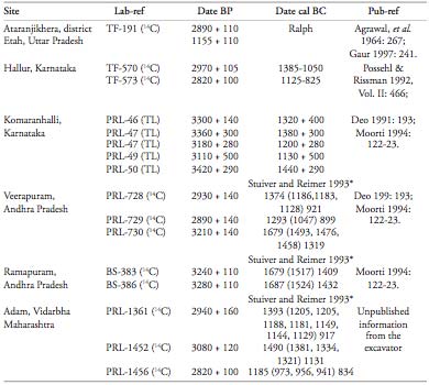
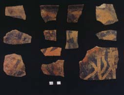
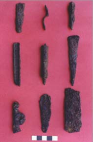
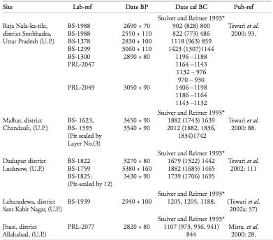
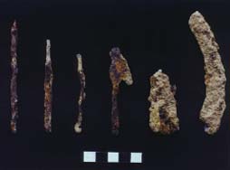
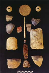
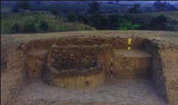
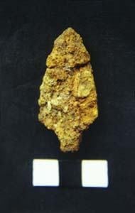
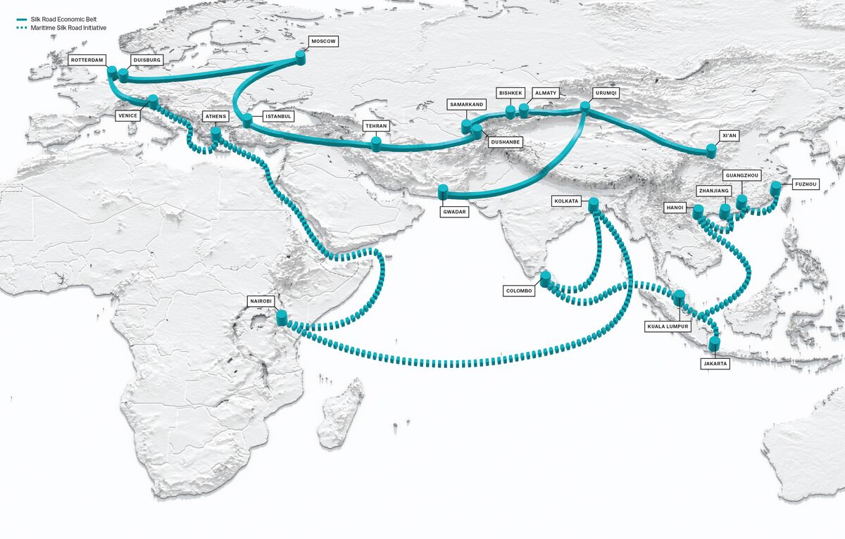


 Region:


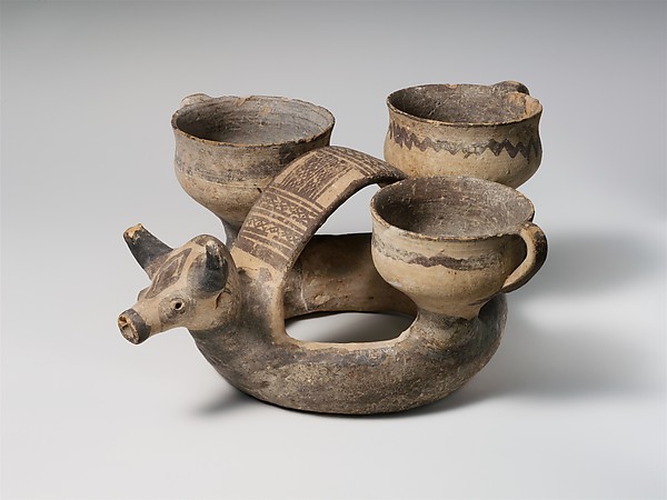


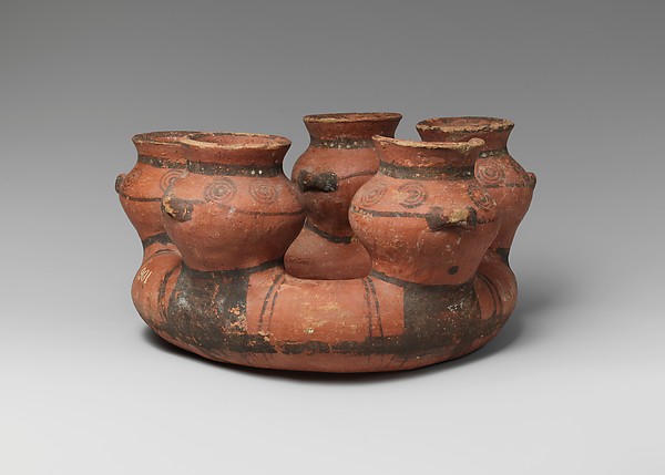


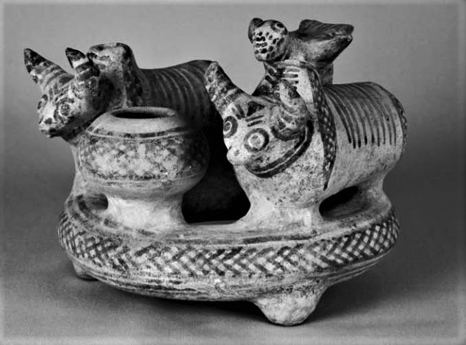
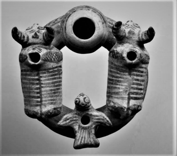
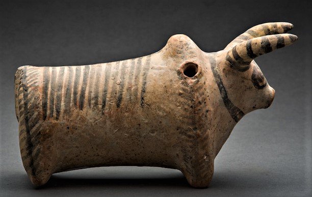


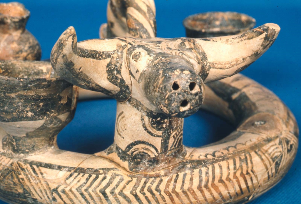


 Santali glosses.
 Daimabad seal.


 Found at


")


 Sarasvati Award


